Tuesday, November 23, 2010

Thanks to Vegas and Canyon

Thanksgiving 2010 saw us packing our bags off to the West Coast. 
Trip Outline:
Fly RDU ---> Vegas. 
Drive from Vegas ---> Tusayan (Grand Canyon South Rim Visitor Center)
Drive back to Vegas...explore Vegas
Fly back Vegas --->RDU
Preparations:
Lots of warm clothes!! Trust me and pack as though you are going skiing...South rim in November can get very chilly!
- Hiking boots
- Tripod and camera 
- Sunscreen.
Day 1: The Road trip
Our flight arrived in Vegas at about 2 am. We picked our rental car and started our drive at approximately 3 am after sufficiently caffeinating ourselves. This route chosen by  Rahul after some research encompassed parts of  Nevada, Arizona, Utah, Arizona again, and touched  bit of Zion National Park, Utah. 

View Larger Map
The Drive from Vegas to Page, AZ
I am at a loss of words to describe some of the beautiful sceneries we encountered on our way...I hope these pictures speak more than a 1000 words!
Surreal sunrise
Road to....??? 
                 Entering Glen Canyon                                                                 Small town in Utah

Lonely Rock, Lake Powell, Utah

Just to give you a perspective of the size of this rock, spot the white caravan in front of it..

Glen Canyon Bridge
Interesting rocks and patterns of the canyon
In front of the Glen Canyon Dam and Bridge

We set out to our next destination, Horseshoe Bend, on the way to Page, Az, located on Hwy 89. Look out for a sign board that says "Horseshoe Bend Overlook". Follow the sign to a clearing where you will see cars parked. There is a trail (about a mile I would say) that leads up to the view. On a hot day this can be very treacherous, because the trail is largely open desert land, studded with sandstone rocks with pretty patterns that make you sit down and meditate! As we walked up to the overlook, we had no idea about the magnificence of the sight that awaited us...its a several hundred feet drop of rock that stares over a beautiful emerald necklace made by the Colorado river just before it flows into the Grand Canyon. The size of the rock instantly makes you feel tiny!


We spent about an hr or so here, and I had to literally drag Rahul away from the bend. Its was a photographers paradise!
We left the overlook and started on our drive to the South Rim..another 2.5 hr to go.
We stopped on the way a couple of times just to take the desert pics...we caught some green lights in the sky (below).


Can you see Aurora Borealis as far south as Arizona/Utah? Creeeeepy!

We reached Tusayan, AZ (about 6 miles from the South Rim Visitor Center), where we had booked an inn. Many people I know who visited GC prefer to stay an hr or so away in Page, AZ, mostly because there are more hotels. We however preferred to stay closer as our activities were mainly planned in and around the South Rim.
Ready for day 2, we unpacked and retired for the day. Still jet-lagged (remember we flew in from North Carolina, and have had no sleep since 2am!!), we slept like babies...zzz

Day 2: Sunrise!!!


Add caption
Luckily for us, being winter the sun let us sleep in until 6:30 am. With a cuppa, and some warm clothes, we rushed out to secure a spot to view the sunrise. The GC being so vast, picking the right spot was a challenge, but after asking around, we picked Maricopa Point. This link is a pretty good guide. Try to get there at least 20 min before the sunrise, and wear layers of warm clothing...I certainly recommend ear warmers, beanies and warm footwear. The desert winter can be cold, but early morning desert winters are a double whammy!! That day in particular was below freezing and the sun decided to not keep up with time. Although we got pretty shots, we could not feel our limbs and ears by the end of the sun rise. 

Colorado River
Add caption
After the sunrise we went back to the hotel for breakfast buffer, and got ready to head out for the day. I had a surprise awaiting me. We were going on a helicopter ride over the Canyons!!! Rahul had booked a ride with The Papillon group of of GC. I am not sure of one company is better than another, but we certainly got the bang for our buck with this one! You have plenty of opportunities to take photos and videos during the 1 hr tour over the Colorado River (above, left) North and West Rims (above, right and below). 


After collecting some memorabilia and our photos from the ride group, we set off to the visitor center. Be sure to take a map with you of the free shuttle bus routes. The buses run from before sunrise to after sunset to all the points of interest. We decided to do a short 1-2 hr hike down the canyon and back. It was a beautiful sunny day, although the trails were a little icy, making our hike more adventurous! Carry plenty of water, fruits and snacks with you, dress in layers and wear hiking boots.
2 hrs later, we took the shuttle to the West end of the Canyon to watch the sun set which is spectacular! What a view to end the day!


Sunday, October 24, 2010

Day 2: Linville Falls and Grandfather Mountain


The next day, we had some decent breakfast by the hot tub, watched the sun rise over the greenery in the backyard and let our dog loose...Our plan was to return back home, again taking the scenic route.
It was a beautiful day, perfect for taking photographs and letting the top down.
We started at around 10 am. An hr later, we reached the Linville Falls Visitor Center, located near Milepost 316. One of the most challenging hikes is the 12 mile long Linville Gorge, which offers beautiful views of the falls surrounded by the steep walls of the gorge. Our plan was to do a short 30 minute/way trek to the Falls, called Erwins View Trail. The route was beautiful, and Neo made a lot of canine and human friends.


We took a few shots by the falls, admiring the beauty and the colours, and started our drive back on the Parkway. We only wanted to take a birds-eye view of Grandfather mountain (look out for the mile posts), so we stopped  (I think) at Mile post 310. Here is the view that we got! Pretty, isn't it?


The drive back was mostly uneventful, but spectacular nevertheless. We had lunch by a beautiful lake (gobbled up all the leftovers from the night before) and relaxed for a bit. I highly recommend bringing your own food and having it by the nature-side. Its so simple, yet a most satisfying experience. I know now why so many poets and philosophers get inspired by nature...The Blue Ridge experience was so surreal that I think it might have converted Neo into a thinker! 


Ciao...until the next Fall!

Saturday, October 23, 2010

Day 1: Blue Ridge Parkway

5 Adults, Baby and a Dog weekend out


Being of tropical origin, I did not understand the real concept of 'Fall'...well, that is until now. Fall in and around our house was simply breathtaking. I did not know there were so many shades of greens, yellows and oranges. The leaves were dancing in the cool breeze showing off their new changing colours (I refuse to spell it the American way) every single day. A friend suggested we visit Blue Ridge Parkway, a 469 mile National Parkway most well known for its scenic beauty during Fall. My very worthy husband quickly found a beautiful 4 bedroom wooded cabin in Burnsville...now all we had to do was find 4 people to share it with! Our friends, Sarup, Avani agreed to join us with their son Om and so did our very sportive friend, Preetha. The plan is mapped out here:


View Larger Map


We packed a lot of ready-to-eat food and drinks (as we usually do :) ), and some warm clothes, and set out first thing Saturday morning. Preetha joined Neo in the back seat and tell you what...he enjoyed her company so much that it made me a little jealous :(After about 4 hours of driving, we reached Blowing Rock, an unusual rock, jutting out from about 1500 sf above a gorge. It was windy and a little bit chilly, but offered superb views of the entire Mountain ranges. Omie and Neo bonded here, the beginning of the doggu-baby friendship!


By now most of us were starving, and after striking more than necessary poses with the Fall colours, we set out to our next destination...Bass Lake. On the way, we couldn't stop but stop at this lovely spot...it literally called out "Take a picture!" So we did! Rahul insisted on taking the top down on the Saab, so now we were not just cold, we were also freezing, as we climbed a bit higher. 


Few miles ahead was Bass Lake, where we had planned on the picnic. We set out the picnic mat, and relaxed beside the lake. Pot lucks are so much fun and full of surprises! Neo was tied up to the strongest tree we could find...although he is a dog, he has horse power! Luckily him pulling the tree down did not work, so he did try uprooting it by digging...Smart fella! Feeling refreshed and rejuvenated, we headed out to our cabin. We wanted to reach there before dark, but somehow even with all technology (3 iphones and 1 GPS), we lost our way. Finally we got back on track, followed a spooky trail (it was a dirt road, that seemingly led to nowhere)...and lo and behold, there was our not-so-spooky cabin...at least from the outside!
I wish I had taken some photos inside the cabin, because the cabin 'decor' mainly consisted of creepy looking dolls that had an eye, an arm or some other body part missing. I distinctly remember that one of the dolls had had a surgery, so it had one blue and one red button for eyes...and I can swear that the buttons interchanged after few minutes!

So as you can tell, we had a great time spooking each other out. After playing some cards, we hit bed at about 1 am, reassured that our dog will protect us if any of these dolls decide to come to life...


Saturday, November 21, 2009

The Weekend Getaway to Gangtok and Nathu-la

Day 1: Exploring Gangtok 
Located in the Shivalik Hills of the East Himalayan ranges, Gangtok ("hill top") is a small yet diverse town with a strong Buddhist culture and later as we learned...the friendliest people I have come across! 
We started from Calcutta in the evening (Kanchankanya Express) and reached New Jalpaiguri station the next morning. We had organized our trip and stay through the Iris Villa. They came to pick us up from the station and drove us to the hotel. It was an interesting car ride, bumpy for most of the route and about 3-4 hrs later we reached our abode in Gangtok.

On our way, we saw 2 army vehicles
juggling through a narrow 'road'
Entrance to Iris Villa
The location of the hotel was very interesting, it was on top of a hill...well, most of Gangtok is built on a hill which instantly means you get a penthouse view, regardless of where you stay! After freshening up, we decided to walk up to Ganesh tok, (a small temple of Lord Ganesha, the elephant God), which offers a spectacular view of Gangtok.
View of Ganesh tok from below
It took us about 30 min to walk up to the summit. On the way up we caught glimpses of kids playing street cricket that brought back memories from our childhood. Once you reach Ganesh Tok, the view is stunning. You can spend an hour or even more here enjoying the serenity of the place from 6500 ft above.


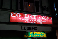
We decided to wait until the sun went down and caught some shots of the TV tower in the orange back drop. It is also very common to see colourful displays of prayer flags all along the countryside. After the hike up, we were still full of energy. We decided to take a taxi ride to downtown, MG marg. You can either share a taxi (cheaper) or get a private one, but be aware that the charges are fixed (~Rs. 30-40). The taxi drops you off at the beginning of the road, no vehicles allowed on the MG marg! The downtown is an interesting stretch of road with gift/souvenir shops, clothes wear, winter wear and Assam tea. In short, it was paradise for me! Although the handicrafts can be pricey, you can window shop around and bargain with the shop keepers, after all thats what makes shopping interesting right? A singing bowl, some handcrafted fans, Tibetan woolen beanies, gloves and a box of Assam tea later, we made our way back to the our hotel, where we were welcomed with a scrumptious 4 course meal! Oh what a delight! 
Day 2: The Nathula experience
We were told you can see Kanchenjunga from Gangtok, the 3rd largest mountain in the world. We just didn't know which one it was, because every where you look there are snow covered peaks! We were ready by 5:30 am, and set out on a walk to see the sun rise. We came across couple of aspiring monks and asked them to guide us (pun intended), and they led us to the 200 yr old Enchey Monastery. We were welcomed by this beautiful view of Kanchenjunga!
Kanchenjunga
The Monastery itself is beautiful and has a certain feel of peaceful energy to it. The little monks showed us the prayer halls and prayer bells. Rohit even demonstrated how to spin the prayer wheels. 
Little Buddhas
Why 54 km takes 3 hr!
He explained that spinning it in the right direction will accumulate wisdom and good karma and is almost equivalent to chanting prayers. I was amazed at hearing these words from a 8 year old. For being a brat and prankster as a 8 year old and chasing my little brother around the house breaking things and getting constantly into trouble, I instantly felt ashamed and spun the prayer wheel as loud as I could, praying for my sins to be excused...Thank you , Little Buddhas! You made our day more meaningful and somehow I feel little more enlightened than yesterday... We said our goodbyes and returned to the hotel, where our tour guide was waiting to drive us to Nathula...the pass of listening ears. 
To visit the Nathula pass you need to be an Indian citizen and have to obtain permits one day in advance in Gangtok (we did that in downtown Gangtok). Visits are only permitted on certain days, so check in advance if you are planning a trip. Although Nathula is only 54 km from Gangtok, the roads are 'kachha' (dirt road), hence it takes about 3 hrs to actually get to the top (picture on the left). Travel is also highly dependent on weather conditions which as you can imagine is pretty unpredictable, as the region is surrounded by mountains. The terrain changes from sub-tropical to alpine to tundra as you drive up. The zone encounters land slides very often, and road are maintained by Border Road Organization. We stopped briefly for refreshments on the way at Himalayan Cafeteria. You get to see Indian Army bases and as you approach the pass. They check your paper work and let you through to the summit. You almost feel a sense of patriotism as you approach the top and see the words "Mera Bharat Mahan" on the mountains. Since the pass connects the state of Sikkim with China's Tibet, you can see both Indian and Chinese officials posted here. The Indian officials are very friendly; be sure to take your photograph with them!  You can also see the Chinese check post from our side, but they are not very happy to pose for you. I noticed a Chinese official taking my picture as I was trying to focus my camera on him, and quickly turned away. We must have spent about an hr here.

There is a cafe and a small shop where you can call your family! We started our descent soon after and stopped by the Tsongmo Lake (also called Changu Lake). It is a glacier lake and makes a pretty picture with the mountain back drop. You will get a chance to ride a yak here. Mine was named Shahruk Khan ;) Unlike the actor, my hero was very strong and to be honest a little stinky, but really who cares, right? Within minutes of reaching the lake it got overcast with clouds. 
Lake Tsongmo
This being our last stop, we headed back to the hotel to pick our belongings and left for New Jalpaiguri. The people, the landscapes and the little Buddhas had left a deep impression in our hearts. We left Gangtok as happier, and hopefully wiser individuals.


A day in Ayodhya

Ayodhya, the birthplace of Lord Rama, is a place steeped in history and spirituality. However, our recent visit there was a mixed bag of emo...